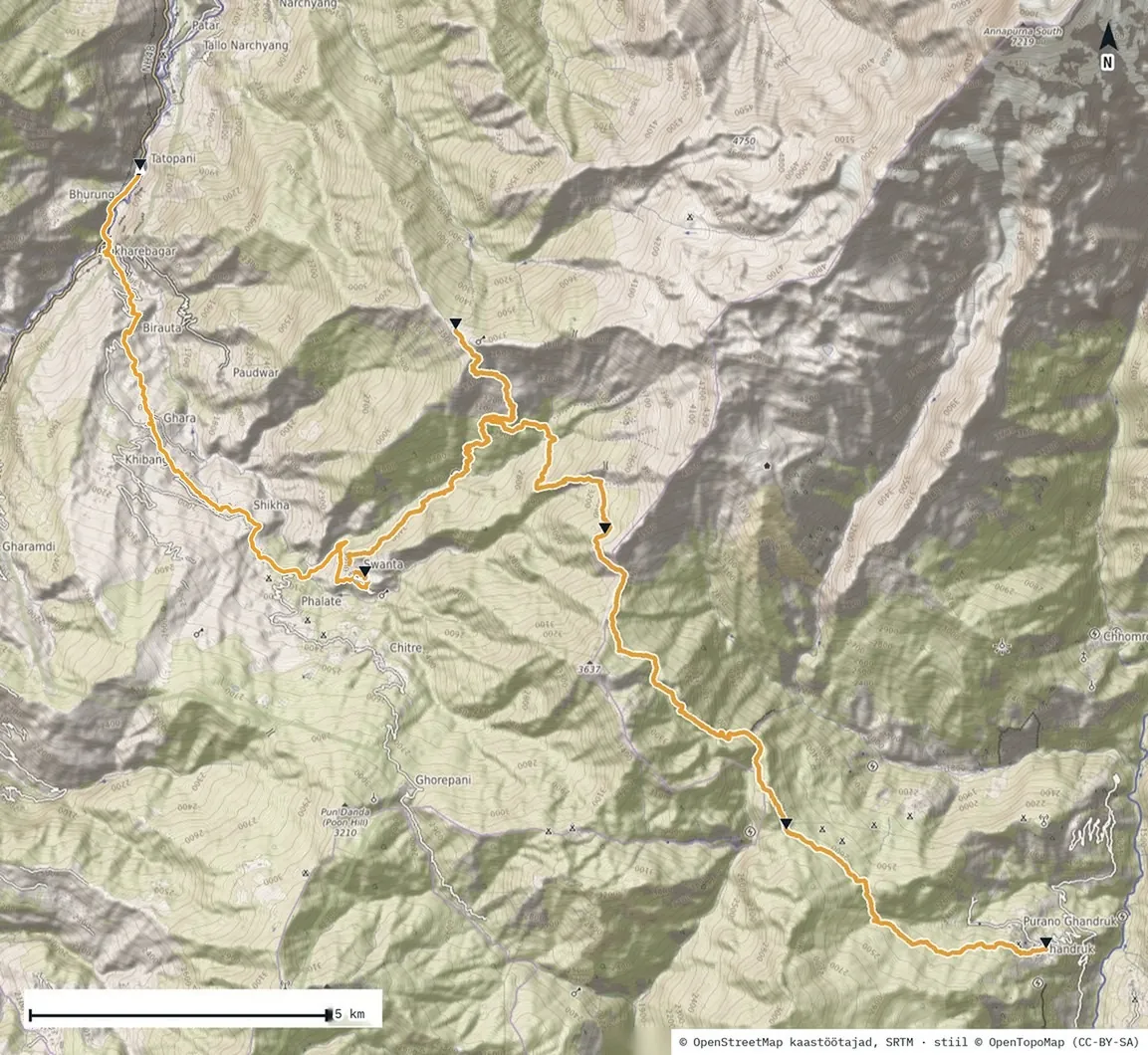
And just like that, it’s the last day of the trek. As I write, it’s already behind me.
The last descent
At the start I managed to get lost. The plan said 11.6 km; my watch ended up at 13.46. I found the way again, and then came a lovely descent through villages, partly along a road. In two hours and fifty minutes I dropped 1,248 metres.
A couple of kilometres before the end there was a choice: high suspension bridges or the road. Of course I took the bridges. Honestly, someone afraid of heights probably wouldn’t cross them. I’m not, so I did. It was quite an experience.
I immediately remembered the videos from late August, when a glacial flood in the Trishuli valley, far to the east, swept away 27 bridges just like these in one go. It left me with a deep respect for nature.
The Tatopani hot springs
I’m writing this at the hot spring pools in Tatopani. Tato pani means hot water in Nepali. Foreigners pay 150 rupees to get in (≈ 0.88 €, ≈ $1); for locals it’s free. There are plenty of them here, soaking in one pool after another.
Now I’m waiting for the others. Then we’ll go into the pools together, and after that it’s the bus to Pokhara.
The water comes out of the spring at about 69 °C and is cooled to 36–45 °C for the pools. The bigger pool was at the hot end of that range, too hot to stay in for long. For comparison, the US Consumer Product Safety Commission advises keeping a hot tub below 40 °C (104 °F). The other pool, which I skipped, was gentler, according to my companions, and you could stay in it longer.
The trek in numbers
In five days, 47.6 km, 3 km up and 3.8 km down. Highest point 3,669 m on my watch; the signpost on Khopra Danda says 3,660 m. The hardest day was the second: more than a kilometre of climbing in one day. Hardest on the muscles was the fourth, 1,558 metres straight down.
The body adapted as expected. At altitude my resting heart rate rose from 52 to 58, and blood oxygen fell to 92% on Khopra, with a lowest reading of 87% in the night. Two nights after coming down from Khopra, back in Pokhara, both were back to home values: heart rate 52, oxygen 97%.
- Distance
- 47.6 km
- Total ascent
- +3,050 m
- Total descent
- −3,842 m
- Highest / lowest
- 3,669 / 1,191 m
- Walking time
- 13 h 33 min
- Energy on the trail
- ≈ 6,440 kcal
- Steps over five days
- 102,322
Nights| Night | Elevation, m | Sleep | Resting HR | SpO₂ %, avg / min |
|---|
| before | Pokhara 796 | 8 h 35 min | 52 | – |
| 1 | Tadapani 2671 | 7 h 38 min | 58 | – |
| 2 | Bayeli Kharka 3456 | 8 h 17 min | 57 | – |
| 3 | Khopra 3660 | 8 h 20 min | 58 | 92 / 87 |
| 4 | Swanta 2261 | 7 h 16 min | 55 | 94 / 88 |
| 5 | Pokhara 796 | 6 h 19 min | 52 | 97 / 90 |
Measured: Garmin Fenix 7 Pro Solar